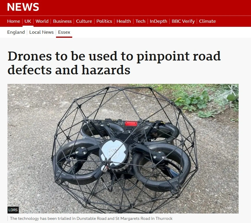
Thurrock Council is using drone highway inspections to find defects on hard-to-reach structures without sending staff onto steep embankments or into confined spaces. The trial, delivered by ProDroneWorx and reported by BBC News on 29 September 2026, used specialist drones with high-resolution cameras and SLAM LiDAR scanning to survey highway structures on Dunstable Road and St Margaret's Road in Thurrock, Essex.
Every highway authority in the UK has assets that are difficult, slow or unsafe to inspect. This case study explains what Thurrock did, what the council got back, and how the same drone inspection approach can work on your highway network.
At a glance
• Client: Thurrock Council, Essex
• Location: highway structures on Dunstable Road and St Margaret's Road
• Site conditions: steep embankments, dense vegetation and confined spaces
• Technology: specialist drones with high-resolution cameras and SLAM LiDAR scanning
• Outputs: 3D point clouds, location-referenced imagery, a defect log and a digital baseline record
• Coverage: BBC News, 29 September 2026
The challenge: inspecting hard-to-reach highway structures
The highway structures on Dunstable Road and St Margaret's Road sit among steep embankments, dense vegetation and confined spaces. Inspecting them the traditional way means sending engineers onto unstable slopes, through undergrowth or into enclosed structures.
That approach is slow, often needs access equipment or traffic management, and puts staff at risk. It also makes it harder to spot problems early, before they turn into expensive repairs.
Our approach: drone and LiDAR surveys with nobody in harm's way
ProDroneWorx surveyed the structures using specialist drones carrying high-resolution cameras and SLAM LiDAR laser scanners. Nobody had to enter a hazardous location.
Each drone survey delivers three things:
• Capture: detailed 3D point clouds, location-referenced imagery and condition data from embankments, vegetated areas and confined spaces.
• Record: a digital record of each structure, which becomes the baseline for future inspections.
• Flag: defects identified and logged against their position, so engineers can see where further investigation is needed.
Confined space drone inspection of culverts and chambers
Where structures are enclosed, such as culverts and chambers, we use the Elios 3 collision-tolerant drone. It flies inside the structure from its entrance and captures video, still images and a LiDAR 3D model, so there is no need for confined-space entry. Read more about our tunnel and culvert inspection and confined space inspection services.
Results for Thurrock Council
The council now has detailed condition data to prioritise maintenance, target repairs and inform future investment in its highway network.
"These surveys give our engineers detailed information without needing staff to enter difficult or hazardous locations, helping us identify issues earlier and make better decisions about maintenance and repairs." Richard Bingley, Leader, Thurrock Council
• Safer: no staff on steep embankments or in confined spaces.
• Faster: structures surveyed quickly, with less time on site.
• Better decisions: defects found earlier, before they become costly failures.
• Reusable: a digital record to compare against on future inspections.
Why drone inspection makes sense for local authorities
Councils are maintaining ageing highway assets on tight budgets. Drone inspection cuts access costs, so more assets can be inspected for the same budget and maintenance can move from reactive to planned. Several structures can be inspected or surveyed in a single day, which makes it very cost-effective.
How we deliver drone surveys for councils
Scope: we agree the assets, priorities and outputs with your engineers.
Plan: site-specific RAMS, airspace checks and permissions, shared before we mobilise.
Capture: drone and confined-space surveys, with several assets covered in one visit where possible.
Deliver: condition imagery, point clouds, 3D models and CAD, in formats that drop straight into your asset management and GIS systems.